Drone Applications in Mining
Stated below are the key shifts on how drones are being utilized or are going to be used across the mining industry, as identified by GlobalData.
1. Site safety management
Application of drones for gathering visual data specifically of inauspicious and volatile areas like deep and high terrains of a mine, crests, high walls, and inside stopes. Further, aerial data capturing from blast sites decreases the risk of exposure on the ground to such dangers.
2. Tailings dam management
The utilization of drones to measure tailings dams could stamp out the risk of manual surveying. There is only a little need for manual interference within the proximity of the dump when drones are around. By analyzing the captured data on a digital platform, mining companies can sustain the structural integrity of the tailings dam, design expansion, and avoid failure.
3. Automatic surveying and mapping
Normally, surveying and mapping mineral landscapes could also be a time-driven process. By employing drones and a drone pilot instead of a piloted plane a mine can save around ninety percent of the cost per hour, and collect unlimited aerial data, including evaluation by simultaneously capturing high-end orthoimages.
4. Monitoring and inspection
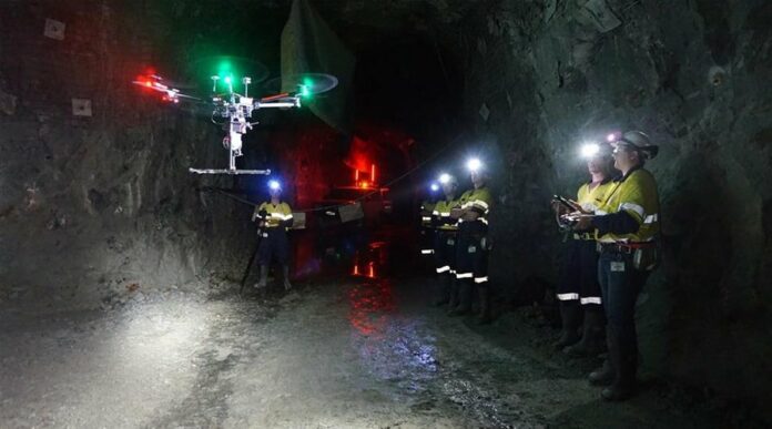
Mining is amongst the foremost unsafe industries for workers, especially those performing deep underground activities. Laborers are often put through to rock falls, extremely humid conditions, gas leaks, dust explosions, or floods, amongst other hazards. Accordingly, mining companies have utilized drones at underground mines to inspect and detect deep underground shafts.
In addition, drones are also being employed for the inspection of mining equipment, which is a rich and time-driven process that requires a highly skilled workforce.
5. Haulage road optimisation
The haul road network features a significant impact on the efficiency of mining activities. To attain safe and uniform transit, the haul road conditions must be constantly monitored. Drones can facilitate this procedure by collecting an outsized amount of aerial data, covering wider areas more precisely, which can then be used by engineers for planning, designing, construction, and maintenance of haul roads.
Follow and connect with us on Facebook, LinkedIn & Twitter

